George D Seymour State Park

28 03 2018

Seymour SP 1

From the DEEP site: George Dudley Seymour was a man of vision. In 1883, at the age of 24, he began his law career in New Haven. His great success as a patent attorney provided him with the wealth necessary to fulfill his desire of land preservation in many areas of the state. In addition to the acquisition of this 334 acre park which bears his name, Seymour and his foundation acquired all or part of seven other state parks: Beaver Brook, Becket Hill, Bigelow Hollow, Hurd, Millers Pond, Platt Hill, and Stoddard Hill state parks and the Nathan Hale State Forest.

This park location in Seymour’s name was once the estate of George, Henry and Thomas Clark. Their Clark Cutaway Harrow Company in Higganum successfully produced cider presses, disk harrows, hay spreaders, plows, carriage jacks and other necessities of the day in the late 1800s and into the early 1900s. Their wealth enabled them to purchase the land and build their family estate at this location along the Connecticut River. The estate was called Clarkhurst for their own surname, and -hurst, meaning a wooded piece of rising ground.  Here along the floodplain their comfortable lives played out and their agricultural tools were tested.

Over the years Henry purchased the property from his brothers, but with his passing in 1914 the mansion and many buildings began their decline.  Deeded to his daughter in 1921, she attempted the maintenance of the property through the development of a golf course and other recreational facilities. But by the depression years of the 1930s, overgrowth and structural collapse had sealed its fate.  In 1942 the land was acquired by Mrs. Marion Guthrie who, though she attempted its quick sale ultimately held it until 1960.  Gladly the George Dudley Seymour Foundation provided the $60,000 necessary and the Connecticut Forest and Park Association was able to purchase the land for the state.

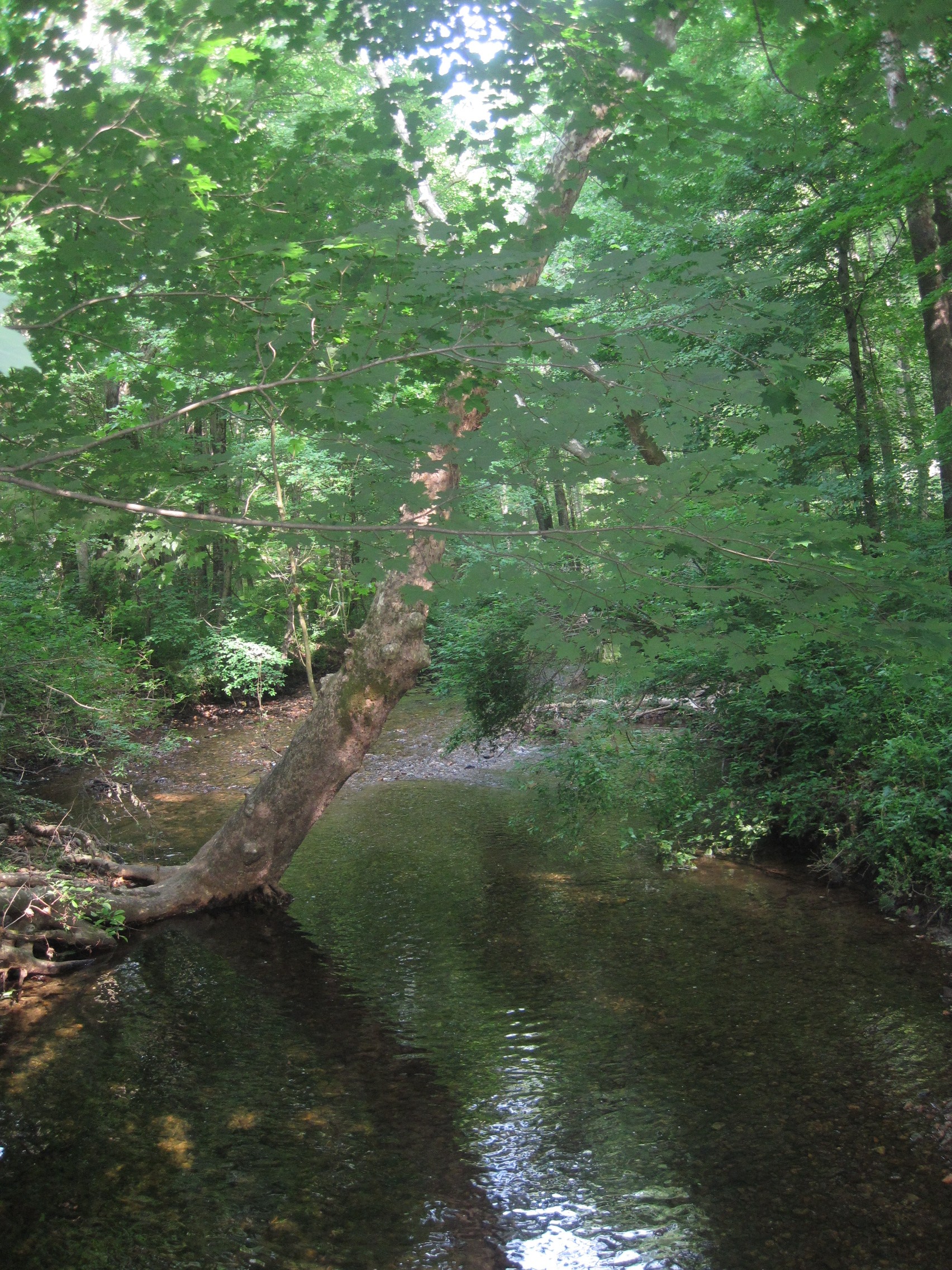
It is interesting to note that native grasses across the state have been altered or replaced over time as a result of various land uses. But here on these floodplain soils, grass species that date from the 1600s or earlier can be found. These grasses predate European colonization and represent a time only the Native peoples were witness to. These and other grasslands within the park provide an excellent location for bird watching. In the spring of some years the DEEP manages this habitat with mowing and through controlled burns.

Wrasslin Cats 1

We lunched at Two Wrasslin’ Cats, East Haddam. Good food, great ethics, home to Saturday vigils and various marches.


Swan Hill, Haddam

26 06 2013

Swan Hill 06.26.13 001It was hazy. It was hot. And it was humid. But Cherry and I, along with a million or so mosquitoes, trekked the Swan Hill preserve in Higganum. We began June 26, at 8:30AM, parking at Haddam Elementary School during the first week of summer vacation and the first (unofficial) week of Cherry’s retirement. We skirted the playing fields and entered the woods at the northern most trailhead. We started our conversation with a discussion about communication and its challenges.

We hadn’t walked far before we crossed a Bible Rock Brook, looking lovely and refreshing today. WeSwan Hill 06.26.13 003 climbed uphill to reach 240-foot Swan Hill and amazing views of the Connecticut River. We enjoyed the small bench at the top and continued assessing the pluses and minuses of several situations we were confronting. We were interrupted by a shout from a hiker, who turned out to be a church friend of Cherry’s and her two dogs. After a fun conversation, they continued on their way and we sat a bit longer before continuing in the opposite direction.

The trail map (available at http://haddamtrails.org/wp-content/uploads/2012/08/SwanHill.pdf) did not include all the options on the ground. But we meandered around and were always surprised to discover where we ended. It was virtually impossible to get lost, but we were rarely certain where we were.

We enjoyed the second vista that overlooked Higganum and the reservoir, where we had hiked earlier. By 10:30 we were happy enough to find ourselves again at the main trail junction and headed back to the cars, taking the more southerly trail back to the school playing fields.

This may be the last of our Haddam trail hikes. We have set up our next adventure to be in the town of Deep River, and will take a day to explore some of its historical, natural, and cultural amenities.


Haddam Trails: Route 81 Loop

24 05 2013

Route 81 loop 002On Monday, Cherry and I continued our Haddam trails visits with a hike at what is called Route 81 loop. We found the trailhead on the north side of Beaver Brook Road, west of the junction with Route 9, and began our hike around 8:45AM. It was cool and gray as we crossed a gently flowing stream and wandered through dense vegetation. The trail was initially distinct and we had a map. Keep to the left, we decided, in order to avoid inadvertently leaving the main trail and ending up at one of the other parking areas.

 Cherry talked about nearing retirement and all the activities she’d been pursuing. Between church variety shows and a Master Gardener trip to the Cloisters, symphony performances and trying to clean out her files, she had been quite busy. She affirmed that this was the right decision for her and we laughed about how the timing evolved.

Route 81 loop 003

We found a live oak peppered with pileated woodpecker holes and trekked through large laurel thickets. We had surprise eye delights of swamp pink and lady’s slippers along the way. Cherry said she’d decided not to travel to Buenos Aires, but would be joining a church group to the Holy Land in February. She would have plenty of time to renew her passport and have something to look forward to all winter.

Route 81 loop 007We crossed several small streams cascading over bedrock. With newly emerged leaves, the mixture of colors and patterns, combined with bird calls, the trail was enticing. I managed to discover yet another tick imbedded in me (that made three over the past 24 hours) and another crawling on me. I talked about progress with my city project to convert an old school to a senior center and the improved health of the 90 year old woman I assist (after a fall and stint at the hospital, she was now at the rehab center).

The area was delightful, showing little sign of overuse. However, in a few sections, more bright green trail markings would have been useful, and perhaps a sign indicating the direction of the side trail to parking. After about two hours, we’d returned to the car parked on Beaver Meadow Road, completing a 2.7 mile loop. True confessions? We stopped by a local shop in Higganum to grab a snack, sit at an outside table, relax together, and schedule our next trip.


Middlesex County Rocks!

20 05 2013

Jim at Bible Rock 001Jim, who’s interested in caves and rocks, visited yesterday from Pittsfield, MA, so we did a rock tour of Middlesex County. We started at Bible Rock in Middletown/Haddam. Set back about a hundred feet from the road, this eight-foot high split rock looks like an open book, or Bible. The nearby brook is also named after this feature.

After taking photographs, we crossed the road to take a brief stroll along the rocks and stream flowing near the Seven Falls picnic area. Likely a CCC project, a mostly-intact table served as a spot for us to review maps and set our next stops.

We agreed to drive north to Dripps Road and visit Spiderweed, a Nature Conservancy preserve. After a brief exploration Spiderweed 002 of the ruined cottage, we reached the beryl-rich pegmatite outcrops and saw Appalachian sandwort (Arenaria glabra). Common to the south and abundant in these unusual rock formations in the north, it’s a spring flowering annual. We caught a glimpse of the Connecticut River through the lush spring foliage.

After a snack and return to the car, we drove south to Durham to start on the Mattabesett Trail leading directly to Coginchaug Cave. Rising thirty feet high and stretching more than fifty feet along the base of a cliff, it provided shelter to Native Americans long ago. Blacked rock and stone fire pits suggest recent fires but artifacts have apparently been uncovered at this site.

When we returned to the car, we decided to take a lunch break. We then went across the Connecticut River to Portland to try to find Bodkin Rock. After several futile efforts (and getting covered in low-tide mud), we decided a water approach would be more successful and would have to wait for a future adventure.

Before returning to Middletown, we drove along the old Portland quarry, recently converted into a tasteless zipline and water park (preference for the natural features showing here). By then, it was raining and the park was closed to visitors.

The Ledges 001In Middletown, we explored the conglomerate rock ledges off Kelsey Street. We saw flowering lady’s slippers and columbine, along with a long series of shelters. We attempted unsuccessfully to match the now overgrown landscape with some 1910 photos of the area. We enjoyed the flow of East Round Hill Brook before calling it a day.

Obviously, many other rocks of notice and importance are in Middlesex County, but this was a good start!


Higganum Reservoir

29 04 2013

Haddam Reservoir 04.29.13 001Cherry and I were ready to start hiking again! This time, we decided to focus on trails in Haddam, her hometown. We used www.haddamtrails.org as our guide.

It turns out there were thirteen trails in town, of which we’d already hiked one as part of the Mattabessett Trail. There also were three in Cockaponset and we’d tried some of that already. So, today, we started with Higganum Reservoir Trail. A round-trip of about a mile and a half, we knew it wouldn’t take long.

It was a cloudy day with temperatures in the fifties, which made for a perfect hike. At 8:30, we parked at the north end of the reservoir to look at the spillway, comprised of large brownstone slabs. We then meandered through a nearby cemetery to reach Hull Avenue and locate the trailhead. We talked about Cherry’s upcoming retirement and issues related to continuation of her programs once she was gone. She also shared about a potential trip she might take to Buenos Aires in January, which sounded quite exciting.

We were disappointed that the trail was so far from the reservoir, so we bushwhacked down to it and tried to follow along. We did get a few nice views of the waterway, while we talked about the current state of my writing. I talked about an in-progress short story and challenges in completing it by Thursday and Cherry was encouraging about its plot line.

Haddam Reservoir 04.29.13 002 Seeing no clear way to continue along the reservoir, we returned to the trail and encountered two women walking three barking dogs. We were glad to move past them and find the source of the reservoir, a lovely stream flowing over rock outcrops. Reaching the other trailhead, we backtracked, staying on the official trail. Cherry asked about my recent trip to Stockholm and Denmark and I told her about the various foods and sights we’d seen. By then, we had returned to our parked car.

 Since it was still early, we decided to hike along the railroad tracks along the river in the center of town. Not an official trail, it crossed Higganum Cove (a superfund site containing PCBs, municipal solid waste, and asbestos.) before reaching the river. Being very low tide, we were able to explore the small beach before hiking north along the tracks. After a half hour, we turned and retraced our steps and returned to our cars at 11:30AM.

 Cherry hadn’t been to either of these areas, so we had a nice introduction to Haddam’s trails. To top it off, we decided to lunch at Mamma Roux’s on chili and gumbo. Cherry suggested a plan for future adventures that included selecting a Connecticut town and spending the day exploring trails, shops, and museums, and sampling a restaurant. I didn’t hesitate to agree. We’ll pick our first town after retirement at the end of June. Meanwhile, we’ll head back to Haddam in May to sample another trail or two.